



NOAA Custom Chart (NCC) Printing


NOAA Custom Chart (NCC) Printing
Printing NOAA Custom Charts
Paradise Cay Publications is listed by NOAA as a NOAA Custom Chart (NCC) printing vendor. We deliver high-quality prints and offer options such as printing on traditional paper or waterproof material.

DOWNLOAD THE NCC APP USER GUIDE
What is the NOAA Custom Chart application?
NOAA Custom Chart (NCC) is an online application that enables users to create their own customized nautical charts directly from the latest official NOAA electronic navigational chart (NOAA ENC®) data.
Depths can be displayed in meters, feet, or fathoms and there are a few other display options, such as changing the depth at which a shallow water blue tint is applied and the depiction of a "safety contour" based on a vessel's draft.
NOAA custom charts do not have numbers and U.S. Coast Guard (USCG) Local Notice to Mariners (LNM) are not issued for NCC charts.
NCC outputs Portable Document Format (PDF) files using the paper size, scale, and location selected by the user.
How to order a NOAA Custom Printed Chart
- Visit the NOAA Custom Chart (NCC) web app ↗ and create a PDF of what you would like printed. After creating the PDF, it can be downloaded.
- Place your order on this page by selecting print options such as paper material and size.
- Upload your PDF using the upload button before placing your order
- As an option, you may give us a former NOAA chart number and we will create an NCC covering that area (scale and insets may differ).
- Please note: Only one NCC can be ordered and uploaded at a time.
If you wish to order multiple custom charts, please make separate orders for each and we will combine shipping costs and ship your entire order together.
Printed in the USA.
About NCC Charts
The Chart Maker Tool is an online application that enables users to create their own customized nautical charts directly from the latest official NOAA electronic navigational chart (NOAA ENC®) data.
Paradise Cay Publications is listed by NOAA as a NOAA Custom Chart (NCC) printing vendor and can print NOAA Custom Charts (NCCs) created with the NOAA Custom Chart Application.
 An image showing NOAA chart 12283 on the left, in comparison to the output from the Chart Maker Tool in the same location on the right.
Some important things to know
NOAA has sunset its raster nautical charts. What does that mean?
Sunsetting is a term that refers to purposely and systematically phasing out a product or service.
In 2019, NOAA announced its Sunsetting of Raster Nautical Charts. The raster sunset program gradually ended production and maintenance of NOAA traditional paper nautical chart products. NOAA completed the process on December 5, 2024, when the final traditional paper nautical chart was removed from the chart locator and archived.
- NCC charts look different than traditional NOAA charts (see example above).
- NCC charts are printed from the latest NOAA ENC® data available on the day they are made (the date is printed on the chart).
- NCC's do not have numbers. You may give us a former NOAA chart number and we will create an NCC covering that area (scale and insets may differ).
- We will recreate a chart for you, or you may create the NCC yourself and upload it for us to print.
NCC's are available from us in FULL SIZED, or SMALL FORMAT and can be printed on Paper or Waterproof material
Please note: Only one NCC can be ordered and uploaded at a time.
If you wish to order multiple custom charts, please make separate orders for each and we will combine shipping costs and ship your entire order together.
How to use the Chart Maker Tool
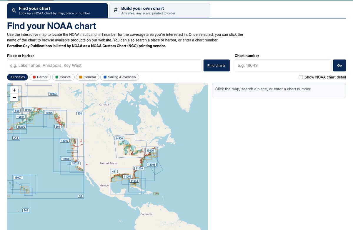
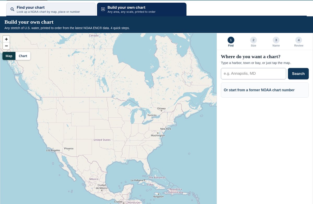
The Chart Maker Tool has two tabs: Find your chart and Build your own chart.
Find your chart
Use this tab to look up a NOAA chart by clicking the map, searching a place or harbor, or entering a chart number. Once you select a chart, click its name to browse the products we offer for that area.
Build your own chart
Use this tab to make a custom chart of any stretch of U.S. water, printed to order from the latest NOAA ENC® data. There are four steps:
- Find — Type a harbor, town or bay, or tap the map. If you know a former NOAA chart number, start from that number and we will set the same area and scale.
- Size — Choose the sheet size, then move the slider until the blue box covers the water you want.
- Name — We suggest a name from your area; keep it or type your own. It prints across the top of the chart.
- Review — Check the preview, pick paper or waterproof, then add the chart to your cart. We print it from the latest NOAA ENC® data on the day we make it.
About Our Chart Options
NOTE: If a chart is marked as HISTORICAL, then it does not meet USCG carriage requirements for commercial vessels. Paradise Cay Publications is listed by NOAA as a NOAA Custom Chart (NCC) printing vendor. NOAA Custom Charts (NCC) are printed on demand when you order, from the latest NOAA ENC® data available on the day they are made (the date is printed on the chart).